
Brack and I had walked very close to the coordinates last December without knowing of its existence. We were not all that sure we would have missed it anyway because we look for such karst features whenever we are out in the woods, but we were willing to give it a go. We left my truck at the park’s north entrance and biked about 3.5 miles along single-track trails, stashed the bikes in a clump of native giant cane (Arundinaria gigantea) and walked from there. We found that we had indeed walked right where the caves are supposed to be last December, but this time we saw no caves or even sinkholes where the caves could be hiding below. Oh, there were three sinks in the vicinity, but they were quite well plugged. Possibly, the original lat/longs for the caves were collected via a different datum and then not converted to the datum the FCS uses?
Ok fine, it was time for a backup mission, and I had one at the ready. I have several times been to the swallets that consume all the normal flow from Blue’s Creek, but always reached them from the south following the creek. I have wanted to come in from the north because there is a karst feature I have been trying to re-find for the last several years, so taking the north route today became Plan B. I non-imaginatively call the feature Limestone Pavement Marsh after its tall sedge vegetation and exposed white limestone ground surface. The rock “pavement” may actually be huge, flat boulders appx 15ft x 25ft x 2ft in size, lying not quite flat on the ground, but in any case, they may cover yet another swallet or two. I stumbled upon this marsh a couple of times over the decades, but always without a GPS, which is why I have been unable to re-find them. I can tell you that aerial photos and USGS Topo Quads are truly worthless in this place. Uplands and wetlands are both dominated by hardwoods that appear identical on aerial photos, and the USGS Topos are wretchedly wrong. Perhaps today would be the day we re-found the lost karst?
We set off following the toe of slope at the edge of Sanchez Prairie, rounding a peninsula separating the prairie from Blue’s Creek Valley and headed south. We did not have to travel far before the valley changed from low hammock forest to (dry) cypress swamp, and after progressing only a few hundred feet more along the west edge of the cypress, we hit pay dirt – huge limestone boulders.
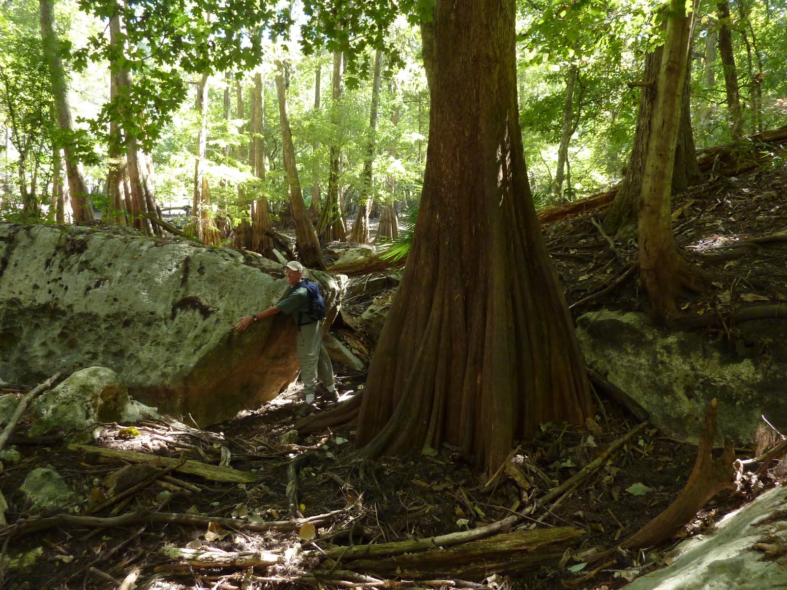
Was this it? Was this part of a wetland that would segue into the sedge marsh and pavement limestone of my memory? I felt certain it would be, so I took my time admiring each 10 – 20ft boulder, photographing many of them, but they finally ended at a plugged sinkhole.

Beyond this was a small sedge and smartweed marsh that did NOT have pavement rock. But no, I was not disappointed. Promisingly, there was more cypress ahead that could yet contain the mission marsh, and I was still flush from finding this spectacular karst feature that was totally unsuspected! To top it off, we also found the shed skin of a diamondback rattlesnake, whole but for the rattles.

Happy enough with these things, I rationalized that maybe it was a good thing we had not found the Limestone Pavement Marsh after all, because now I still have that worthy goal to seek. Sometimes, looking for the pot of gold is better than finding it. On a previous trip, Bruce certainly seemed to think so:

Continuing southward we arrived at the location where Blue’s Creek leaves its main valley and flows into two little karst valleys on the west. These side valleys are where the creek’s water drains into the Floridan Aquifer via several small swallets. Each of these short valleys has very steep dirt side slopes with occasional, sheer limestone walls split by fissures into which the creek disappears.

Ordinarily, the first valley’s swallets take all the water, but as the creek rises in storm events or during wet seasons, it overflows the first and then heads into the second side valley, sumping into both of them.
These two small valleys are very picturesque. All exposed rock is covered with mosses and liverworts, spotted here and there with several species of ferns. Florida’s only species of genuine tree fern, Ctenitis sloanei, maintains a couple of ambassadors at the head of the second valley. These are the northernmost individuals of this species I know of in Florida. Half-way up the second valley, 3 – 4ft boulders are imbedded in the substrate and piled atop each other and the lushness of ferns, mosses, liverworts and wildflowers that carpet them is fantastic.

Even trees try to climb the rock!

Fallen logs are abundant along this boulder section, fodder for ferns, fungi and company. Draped over the entire boulder-and-log maze are grapevines and other vines, plus various shrubs. You cannot walk through this habitat upstream of the above photo – it is too treacherous. If you put your weight on the moss carpet, it will slip off the rock like a loose rug and you’ll faw down go boom. Many of the smaller boulders teeter-totter under your weight, plus you must move gymnastically, gingerly over and under the lianas and logs. So don’t! Instead, just stand at the start of it all and marvel. It may be the most beautiful karst valley I have seen in Florida, and I’d like it to stay that way. I have been here before, but Brack had not, and he wisely refrained from blundering in.
Just north of this second valley, another seasonal stream comes into Blue’s Creek Valley from the east and heads south toward the second valley. This stream drains a hardwood swamp. At its western end is a 2ft-diameter willow. Thinking it was an enormous Coastal Plain willow (Salix caroliniana) I was sure I was looking at an unrecognized national champion tree (the largest individual of its species in the US).

I used to nominate national champs and state champs, at one time having about a dozen of them in my portfolio, and continue to keep an eye out for unusually big trees. Brack and I estimated height/ diameter/ crown spread dimensions to use in checking the books back home, knowing that if it indeed is that worthy we would have to come back with a tape measure to obtain real numbers.
It could also be a black willow (Salix nigra), which can grow to a diameter of 5ft or more, but I have never seen this species on the Florida Peninsula. There is always a first time, so I collected a twig with leaves for later identification. CP willow has whitish undersides to the leaves whereas black willow’s are green like the leaf dorsum, and this tree has green leaf undersides (= black). However, tiny glands at the tips of leaf margin teeth are red on black willow and yellow on CP willow, but this tree’s leaves have orange glands and the book says the two can intergrade. If this were mid-summer and the leaves were turgid and strong, I would be satisfied to call it a possible intergrade, but we are late in the season when leaves are dying, so the red could easily be fading to orange (or even yellow?) by now. I shall have to wait until spring to find out for sure. I plan to notify park management about it next week anyway, because regardless of whether it is a black willow or an unrecognized champion Coastal Plain willow, it is a notable tree that warrants protection.
Peddling back to the parking area, we saw the Traveling Gnome that someone moves around the park:

The rattlesnake skin is a great find!
ReplyDeleteWith all these rock outcroppings, this would be a great place to scout out for Triphora craigheadii and Triphora ricketii. Both these endemic orchids have a strong affinity for rock outcroppings. While T. craigheadii has only been found in the general vicinity of Inverness, T. rickettii hails from somewhere in Columbia county as well.
ReplyDelete---Prem
The Florida Native Orchid Blog
FB, yeah, it was almost as good as finding a real rattler. Brack suspected that it might have been from a brown water snake, but the clearly defined hole at the tail tip cinched it for me as a diamondback.
ReplyDeletePrem, thanks for the tip. You have reminded me to review the Triphora species of Florida and their flowering times so as to be ready for them. So far, T. trianthophora is the only one on my life list.
Maybe today on the Santos trails I will see a Triphora? Probably too cold for a nipper.
It's late in the season for the two endemic Triphora species, but T. trianthophora might still be up...I've seen budding plants mid-November at Ichetucknee Springs State Park.
ReplyDeleteIn Citrus County, T. craigheadii comes up at the end of June and beginning July, with T. rickettii following about two weeks later. I still have yet to photograph the latter species in flower.
---Prem
The Florida Native Orchid Blog